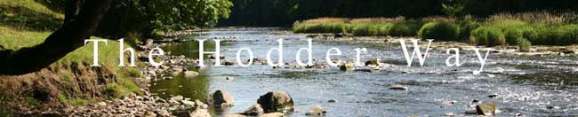
THE HODDER WAY
By Peter Dobson
Length of walk 40 Kilometres (25 Miles) approx
Undulating walk with some short steep ascents / ground boggy
in places
Starting height 427 metres approx, also the highest point
OS Map required, Sheet 103 1:50000, or much better OL41 1:25000.
Forest of Bowland & Ribblesdale.
5BG = Five barred
gate / 7BG = Seven barred gate / m = metres
The walk begins
at the Cross Of Greet north of Stocks Reservoir near Slaidburn,
and finishes where it joins the R. Ribble between Stonyhurst
College
and Gt.Mitton, some 40 km / 25 miles away.
Splitting the walk
into two stages would give you an approximate halfway point
at Whitwell or Dunsop Bridge.
You could stay at “The Inn At Whitewell”, a well
known hotel – it is very popular and accommodation would
need to be booked well in advance.
There is also an
excellent Youth Hostel at Slaidburn; however this is not at
the halfway point. Bookings for this are made through Earby
Y.H.A. The Hark to Bounty Inn close by also offers accommodation
and produces an excellent menu. There is also accommodation
available at the Parkers Arms in Newton.
Source of River
Hodder to Slaidburn. 8.5 miles.
Start by The Cross
of Greet (just a stump to be precise) SD 68227 60850
There is room to park several cars here.
YES - FREE AT
LAST – all the land around is open access.
However there remains the small matter of locating the Hodder’s
source which is in fact more or less all around you. So to make
things simple I made an executive decision and can tell you
it is at Grid Ref. (SD 67922 60580 ) .
Therefore to reach
the source of the R. Hodder I suggest you follow the fence (opposite
side of road/cattle grid side) from the Cross of Greet stump
S. W. towards White Hill for about 350 - 400 M.
Where the fence
makes a slight bend left you should see, weather permitting,
on your left some boggy ground with areas of longish grass interspersed
with pools of standing water. This area I have defined as the
start of the R. Hodder. Looking eastwards towards a large hill
- Carlow Hill, you will also see that the areas of long grass
lead downwards into a developing trough which, if approached,
will lead to a small stream - the infant R. Hodder.
Once you have located
the stream it’s best to follow the right bank i.e. its
south side, which will take you close to the road and eventually
to where another stream joins. The stream joins from your right
and it’s best to aim for the right bank of the now larger
water course - I leave you to contemplate the implications of
that.
Because there is
no footpath i.e. opens access – hoorah! ; you can follow
the developing stream in your own way utilising the numerous
sheep tracks that generally run 20 - 30 ft above it for the
next 1.40 km. After which another stream joins from the right
having passed through a small quarry - the spoil heaps of which
are stacked on your right also. Cross the joining stream and
aim for the disused railway track some 100m diagonally right
of the stream you have just crossed. You then follow the rail
track for some 600 metres till you can join a shooting track
that is visible on the right. Once on the track you cross a
flat concrete bridge and a gate gives access to the highway.
Turn left and cross over The Cross of Greet Bridge to a F.P.
sign pointing right on the other side. Follow the F.P. sign
downstream on the east bank close to a wall at first. The path
eventually tends away from the river. Go through a gate to ford
Kearsden Beck, then go to the right of the next to follow a
track between the fence and the river to meet a farm access
road. Follow the access road upwards to a wood 5B gate. Go through
the gate and head immediately up and leftwards ignoring a track
straight ahead. When the track disappears, keep the gate and
the wall on the left and walk to the wall corner. Go through the gate and over rough ground
to reach a barn, passing above Catlow Farm.
On reaching the barn near some shake holes go south down the
rough field, access land, to eventually use a farm track which
goes through a gate and onwards to a barn referred to as New
House on the OS Map ( SD 72012 58070 ). Aim for the concrete
farm road and continue south towards Stocks Reservoir until
you cross a bridge over Hasgill Beck. Continue along this path
(now signed as the Stocks
Circular Route) which follows within
sight of the reservoir edge until you reach the viewing hide,
picnic tables, visitor car park and information boards.
From the car park
go along the road, or a path beside it, to cross the causeway.
Use the road for 400m where at the end of the trees on the right
a stile leads into an open field, still signed Stocks Circular
Walk. [The interesting Dalehead Church
is a further 300m up the road, see notes.] Go up the field through
a band of trees and continue above the reservoir with superb
views. Follow the track through the first plantation and then
fork right to keep right of the second plantation and continue
towards the dam. Just before reaching it go up the steep bank
and gravel track on the left. Where the track starts to go downhill
look for a stile on the left to access a large field. Here go
straight ahead S.E. to reach a farm track, follow it rightwards
towards Hammerton Hall (see notes). Go through gates to its
left and then down a farm road to a stream with a small flat
bridge. Keep on the farm road with the now visible R. Hodder
on your right. Cross the river on a stone arched bridge, cross
a cattle grid and 100m later bear left onto a signed footpath
by a wall. Go ahead towards Slaidburn but before reaching an
obvious ford bear right and aim for a metal kissing gate just
right of the bridge. Turn left onto the road, up to the war
memorial and left again to the café, car park and toilets.
Higher in the village is the well known Hark to Bounty where
you can get a pint and a meal.
Slaidburn
to Newton. 2 miles.
Opposite the café a signpost directs you between a parking
place and a house, (an old Wesleyan chapel), leading up to a
signed riverside walk. Follow this to the sewage works where
you are diverted round and back to the banks of the Hodder.
Follow the river passing a bridge below the renovated Dunnow
Hall, enter woods by a metal kissing gate and eventually along
a concessionary path in newly planted woods. Go right through
a wall stile, then left over footbridge and on to meet the road
at the bridge. Information board. Turning right takes you to
Newton
and The Parkers Arms.
Newton to Dunsop Bridge.
3.5 miles.
To continue turn left across the bridge and immediate right
following FP sign. Cross a field tending slightly leftwards
away from the river till you meet a hedge where steps lead to
a stile. Continue above the river over a stile then upwards
to a stile by a gate, arrowed stone in field. Go up to the next
gate leading into a field where you will see a house ahead,
head for this and just before it cross a stile in the hedge
to the left onto a road.
Turn
right and walk down the road for about 250 m crossing Foulscales
Brook to a gravel track on your right marked Private
Road. Walk down this for another
300 m till you see a FP sign and stile on your right. Crossing
this takes you over a field to a suspension footbridge over
the R. Hodder. Cross over and walk ahead uphill aiming to the
right of the wooded knoll, go round it to cross a footbridge
and field to gain the road at a stile.
Turn left down the road and walk past Boarsden Farm. Look for a F
P sign on your left which takes you down the side of a house
where there is a gate on the right which gives access to a field.
Walk down to the track with your back to the house i.e. west
to a 5B gate at the bottom of the incline and continue on passing
a suspension bridge on your left to a stile.
This takes leads you over a brook and across a field (keeping river
on your left) to a large white painted aqueduct bridge with
a stile on its right. Go over this and continue following the
river till you reach some woodland with another stile on the
left which takes you through a small wood over a foot bridge
and stile to another field. It should now be possible to see
Thornyholme and a large bridge ahead with a group of Douglas
Firs forming its approach from Dunsop
Bridge.
Cross the field in the direction of the bridge to a gate which
allows access onto the road bridge. Turn left cross the bridge
and follow the footpath sign rightwards at the end of the bridge.
You can detour into Dunsop Bridge
where there is a pleasant café and shop that serves hot
drinks and food. They also stock an interesting range of books
with information on other walks and and the area’s local
history
Dunsop Bridge to Doeford Bridge
(via Burholme
Bridge) 5.5 miles.
Follow the path along the river, crossing 2 stiles before approaching
a metal aqueduct bridge. The footpath continues past the aqueduct,
keeping close to the river. Eventually the path leaves the river
and crosses a meadow towards Burholme Farm. At the farm take
the path across the ford or wooden bridge into the farmyard,
(ignore the path off to the left). Go through the farmyard and
the path follows the farm access road to Burholme Bridge.
The track from the farm joins a road by the bridge, turn left away
from the bridge towards the Whitewell Inn, There is a concessionary
footpath (recommended) on the right after about 200m which runs
parallel to the road. There is a gap in the hedge just past
a metal gate where it starts. Following the road or path (accessed
through a kissing gate and across a footbridge) will bring you
to the Inn at Whitewell where
you can break the journey.
Outside the Inn the road forks,
take the left bending road upwards, past a Social Hall, to a
FP sign on your right.
Go up the steps through the gate and walk diagonally
up the field right of the house ahead. Near the house is a green
Aqueduct gate with an interesting tunnel set back. Follow a
track to the right of this into a sloping field. Continue, tending
upwards, to a gate on the right of remains of a small building,
into another field which is crossed to a 5B gate.
Go through the gate and follow the fence, crossing a stile, (S.W.
direction) to a wall & 7B metal gate in the direction of
Laund Wood - keep close to the fence on your right till a large
ornate black gate (probably an access gate for a small quarry)
is reached . Views to the Loud Valley & Parlick Pike on
the right. Continue downwards gaining closer proximity to the
road on the right, (aim for the left of the wood on the other
side of the road). Go through a 7B gate and continue to another
ornamental gate & FP sign is reached by the roadside.
Turn left down the road and after 60 M approx you will come to another
footpath sign and stile on your right. Go over the stile and
then over another by the hedge on the left. Head diagonally
towards the end of a wood on the right some 300m distant. At
the end of the wood go through a gate/stile and continue straight
ahead at first for 200m approx and then, towards the fence by
the river (ignore the two stiles in the fence by the river).
A dirt track develops which takes you to a brook feeding the
river, cross this and continue to a kissing gate which allows
entrance to a field (farm up to the left). Aim between two disused
stone gate posts 100m ahead. Follow this bearing to a stile
under an oak tree and then head upwards for the left edge of
a wood on the horizon and 50m to the left is a stile by a 5B
gate and access to a gravel track.
Turn right down the gravel track follow this until you reach a large
stone farm building with Stakes Farm some 200m beyond. Ahead
there are 2 gates that allow access past a sheep pen. Go through
the gates, turn left and walk uphill past the side of the barn
onto a developing track. This takes you upwards and across a
field to another metal gate which you go through, proceeding
with the hedge on your right, to a post F.P. marker which points
slightly left. Follow the direction of the arrow across a field
for about 200 m to another marker just before the descent down
to the river and Doeford Bridge.
Doeford Bridge
to the Ribble (Fin) 7.5 miles.
Emerge onto the road that crosses the bridge and turn left up the
road and walk for just over a kilometre to a gravel road on
your right at a bend before a barn. Follow the track for 250
m approx and turn left at what looks like a crossroads, walk
along this track for about 100 M to a stile on the right which
affords access into a field. Cross the field along an old hedge
line to drop into a junction of ditches, go up left to a stile
giving access to a field. Aim for the left edge of some woods
ahead where stiles cross pipeline access track.
On passing the woodland walk ahead to another stile and wooden bridge
in the centre of the field ahead, after which you head towards
some pine trees crossing another stile in a wire fence. Walk
to the edge of the woods and find another stile by a wooden
hurdle.
A path then takes you down through the wood to a stone bridge (SD
67277 43520) which you cross and turn immediately right tending
upwards to a footbridge and stile which lets you onto more open
ground. A grassy track continues past a post and up to a stile.
Cross it to another which arrives at something of a highpoint
looking down to the river. From here you traverse down and left
looking for a gate and stile in a hedge some 150 m before the
river. Cross this grassy area roughly parallel to the river
(woodland up to your left) to a 5B gate with stile. Go over
small stream and then ascend steeply (muddy) to cross a stile
in fence on the left halfway up the slope.
Continue ascent of steps to a stile at top of slope – go over
this and up to a useless stile 30M ahead. There is now a signed
variant (sign insert ad been removed on last visit) across the
hillside above the Hodder which you should include as it gives
beautiful river views and allows closer contact with the Hodder.
White waymarks.Turn right at the stile/map follow a line of
fence posts to a metal gate. Continue traversing above the river
by a water trough to another metal gate, past a seat, then ascend
the slopes to a metal gate. Head across the field towards Buck
Thorn Farm. Turn right to stiles over the pipeline to reach
steps which take you down to a stream which is crossed and then
up more steps to a stile and a track which you follow into Aigden
farm yard ( SD 68652 43180 ), Go through the farmyard to a stile,
cross this to another 20m further on in a hedge.
Now in a field you can
follow the old hedge straight ahead for 250 m approx away from
the farm to a stile by a 5BG. Cross another field keeping fence
on right to a stile – over this and go ahead towards fence
and rusty 5BG with stile.
Go over stile and turn left to follow hedge across a field to another
stile with small foot bridge, cross this and walk diagonally
rightwards looking for a stile ahead by the visible farm access
road, cross this stile to join the farm access road and walk
towards the road leaving the farm behind you
On reaching the road [Pub up to the left] turn right to see a split
ahead, take the right fork and continue for 1.30 km approx to
a crossroads, turn right and walk to the Higher Hodder Bridge
560 Metres approx.
Walk to the end of the bridge and turn immediate left (F.P. sign)
onto a well defined footpath which follows the Hodder for some
3.60 Km. Keep to this undulating track following the river.
At one point where you rise through the woods there is an interesting
stone cross. Passing below the commanding Hodder Place buildings
you go through fields to arrive at Lower Hodder
Bridge.
On Arrival at the
Lower Hodder
Bridge
go across the road to a Ribble
Way marker. The remainder of our
route follows the Ribble Way so you can follow the Blue Signs.
There is a narrow access path going ahead for a short distance
to give close up views of ‘Cromwell’s Bridge’.
Walk up the pavement for about 400 Metres to a bus shelter on
your right and there is a FP sign on your left. Go over the
style into a field and cross two more as the ground rises. Views
back to the stately Stoneyhurst
College.
Over the brow you will see off to your right the roof and chimney
of a small building, aim for this and go through a metal kissing
gate in the middle of the field and on to another to the left
of the small building which gives access to a road. Turn left
and follow the road passing by Winkley Hall. Tall trees to the
left are home to a group of herons. Walk on down the track and
walk through Winkley Hall Farm till you can see the Hodder again
and follow the FP sign pointing right. Continue on the track
for about 250 M to a gate where there is a seat and steps down
to the banks where the Hodder and Ribble join. CONGRATULATIONS!
open the Champagne
you have been carrying for the last 25 mile or head for the
nearest pub either at Mitton or Hurst Green.
From here there
are three options for returning
a) About turn and
retrace your steps to Lower
Hodder Bridge
on Whalley Rd. Longridge - Clitheroe bus service.
b) Look at the
OS Map and you will see It is possible to loop back in a circle
by continuing along the Ribble Way past the Jumbles then off
right to Fox Fields Farm which you can pass leaving it to your
left and eventually onto Whalley Rd. Where turning right will
take you back to the Lower
Hodder Bridge.
The loop is worth while as the scenery is pleasant and adds
about 4 Km from the merge point of the rivers.
c) Continue along
the delightful Ribble
Way for about 3K to Hurst Green,
here there are pubs and transport.
F
I N
Acknowledgements
: I would like to thank
Angela Towers and Bess for their help, patience and companionship
while walking the Hodder
Way. Bess also managed to swim a
good deal of it.
John Proud who
tested my description of the walk and has indeed written up
a marvellous walk of his own called the "Longridge Skyline
Walk"
To obtain details of this walk please us the contact form
Members of Kendal
Mountain Rescue Team : Hilary Fouweather, Chris Rogers and Barbara
who also tested the walk bravely without the use of a map, and
helped greatly in producing the final draft.
Notes
Dalehead Church St. James' Church
Dalehead is a mortuary chapel in the Parish of Tosside. It is located
within the area of the Forestry Commission's plantations known
as "Gisburn
Forest". It was built from stone reclaimed
from the original church which was demolished circa 1936 as
a result of the flooding of Dalehead in the early 1930s to create
Stocks Reservoir.
Stocks Reservoir
It was thought that the original site of the church would be flooded
and so many of the bodies in the graveyard were disinterred
and reburied at the new site which is on higher ground. In actual
fact, the original site at the bottom of School
House Lane was never flooded and
is now a car-park and picnic site. Occasional services are held at the church by the priest in charge:
Reverend Mark Russell-Smith from St. Andrew's Church, Slaidburn.
Hammerton Hall
Hammerton
Hall is a large three gabled building built with a layout resembling
that of a capital letter "E". This was a floor-plan
often used in houses built or altered during the 16th or early
17th centuries. The house has been extended to the rear over
the centuries and at one time was split into two houses.
This
was once the home of the "de Hammerton" family, a
wealthy medieval family who are reputed to have been able to
ride from Slaidburn to York (approx. 50 miles) on their own land!
This
is reflected in the place-names: "Kirk Hammerton"
and "Green Hammerton" near York;
both villages owned at one time by the family. Unfortunately,
the family lost most of their wealth and power when Sir Stephen
de Hamerton joined Abbot Paslew of Whalley in the Pilgrimage
of Grace of 1536. This was a protest against Henry VIII's proposed
dissolution of the monasteries. Sir Stephen was executed for
treason and as a knight was hanged and beheaded in 1537. His
neighbour Nicholas Tempest of Catlow, a commoner who had also
taken part in the Pilgrimage of Grace, suffered an even worse
fate; that of being hanged, drawn and quartered at Tyburn.
The
Hark to Bounty Inn :
Formerly know as the Dog Inn. The building has a long history;
an upper room was used as a forest court when Slaidburn was
the administrative centre of the Forest of Bowland The Inn is
generally open all day with food served:
Stonyhurst College
: Well
known Roman Catholic educational establishment
The facade of St
Peter’s Church is quite impressive. The Church was inspired
by Kings College Chapel in Cambridge and was completed
in 1835. The Jesuits, fleeing from Liege, France,
settled at Stonyhurst Hall in 1794, when it was given to them
by Mr Thomas Weld, heir of the Shireburns. The museum treasures
include the embroidered cap of Sir Thomas Moore, Catherine of
Aragon’s religious robes and a cloak of Henry II’s.
Much older than these, though is the 7th century copy of St John’s Gospel. This
is the oldest example of an English leather-bound book, surviving
from the Anglo-Saxon period.
Lower Hodder
Bridge
: Built
in the1820’s and gives us a most interesting view of the
much older pack-horse bridge. This bridge is reputed to have
carried Cromwell and his armies on their way to battle at Preston.
Links
http://www.slaidburn.org.uk/ and http://www.dalehead.org/